
Remodeling Near Creeks or Bay? Know Poulsbo’s CAO
October 23, 2025
October 23, 2025
Planning a remodel near Liberty Bay or along a Poulsbo creek? A few feet can change your permit path, project scope, and timeline. If you live close to water or a mapped stream, the City’s Critical Areas Ordinance and Shoreline Master Program guide what you can do and how you do it. This quick guide shows you the buffers, the 50 percent remodel rule, permits you may need, and the maps to check before you design. Let’s dive in.
Poulsbo’s Critical Areas Ordinance identifies wetlands, streams, flood hazards, geologic hazards, and aquifer recharge areas and sets rules to protect them. If your project touches one of these areas or its buffer, you will likely need extra review and possibly special reports. You can find the standards and permit triggers in PMC Chapter 16.20.
If your property is within shoreline jurisdiction, the City’s Shoreline Master Program requires that you follow a mitigation sequence: avoid, then minimize, then compensate for impacts so there is no net loss of ecological function. Shoreline permits may be required for work within shoreline buffers or the aquatic area unless exempt. See Poulsbo’s shoreline regulations in PMC Chapter 16.08.
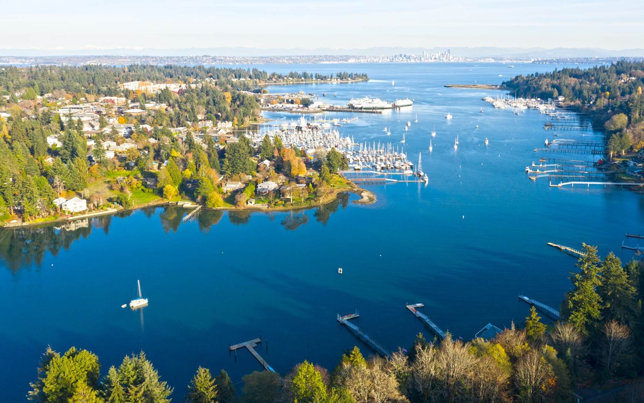
Poulsbo’s shoreline jurisdiction includes Liberty Bay and the Dogfish Creek estuary, with upland jurisdiction extending 200 feet landward from the ordinary high water mark. Within that area, fixed buffers apply:
Poulsbo is updating its CAO in phases during 2025 to align with state law and current science. Phase I focuses on revised stream buffer widths and stronger protections for fish-bearing waters. The City published a “Proposed Stream Buffers” interactive map so you can see potential changes to your parcel. Public review began in August 2025, with adoption anticipated in October 2025. Always check the City’s Critical Areas Update page for the latest maps and final Council action.
Routine maintenance and repair of lawful structures is usually allowed. When a remodel or reconstruction exceeds 50 percent of the structure’s market value, it is treated as reconstruction and typically requires a critical area permit if you are within a critical area or its buffer. This threshold often affects major renovations and expansions near creeks or the bay. You can review the standards and procedures in PMC Chapter 16.20.
Many shoreline or near-stream projects need extra review. Typical examples include:
A Poulsbo mailing address is not always inside city limits. Rules differ between the City of Poulsbo and unincorporated Kitsap County. Start by contacting Poulsbo Planning and Economic Development for guidance or a pre-application conversation using the contacts on the PED page. If your parcel is outside city limits, review Kitsap’s CAO update and contact the County’s DCD. See the County’s adopted update here: Kitsap County CAO Update.
Check the City’s interactive proposed stream buffers and shoreline maps to see if your property overlaps a critical area or buffer. The City encourages early pre-application meetings to reduce surprises. Forms, submittal checklists, and fee schedules are on the planning forms and fees page.
If your site intersects a critical area or its buffer, Poulsbo commonly requires technical reports from qualified professionals. Depending on the issue, you may need a wetland delineation, habitat assessment, geotechnical report, or mitigation and monitoring plan. Professional qualifications and submittal standards are outlined in PMC Chapter 16.20.
Smaller projects entirely outside buffers can move quickly. If you need critical area reports, shoreline permits, or hearings, plan for several months. Review cycles, public notice, and technical studies add time. Costs vary based on report needs, design complexity, mitigation planting, and permit fees. You can preview submittal steps and fees on the City’s planning forms and fees page.
Thoughtful design can reduce impacts and streamline approvals:
Unpermitted work in critical areas or shorelines can trigger stop-work orders, fines, and restoration requirements. If your upgrade will cross the 50 percent threshold, you cannot rely on past conditions to remain. The City’s enforcement and permitting provisions are detailed in PMC Chapter 16.20.
If you are buying or selling near Liberty Bay or a creek, CAO and shoreline status affect disclosures, valuations, and future remodel potential. It pays to understand buffers, permit history, and what is feasible before you write an offer or list. For a discreet, design-forward plan tailored to your goals, connect with Jake Aspinwall to align property strategy with lifestyle and long-term value.
Stay up to date on the latest real estate trends.
Bainbridge Island Market Report
Bainbridge Island Market Report
Bainbridge Island Market Report

Relocation Guide
Everything Bay Area and SoCal buyers need to know about relocating to the Pacific Northwest's most sought-after island community.


Bainbridge Island Market Report

Selling Strategies
Expert Tips and Strategies for a Successful Home Sale in Seattle
Specializing in luxury and waterfront properties, Jake Aspinwall offers a refined, client-centered real estate experience. Reach out today to begin your bespoke real estate journey.

249 Winslow Way E #400 Bainbridge Island, WA 98110